11 p.m., Monday
The ice has been artificially removed from the Rideau River as far as the Minto Bridges now. We could see water flowing as we crossed them just now! Clouds are scudding along from the north with patches of starry sky between them. The parks and gardens are white under today's fresh fall of snow, the wind blowing curtains of powdery snow from the branches of the trees.
Monday, February 28, 2011
Winter putting up a good fight
 |
| Image from the Fletcher wildlife garden website |
The blasting operations on the Rideau River began on schedule, with part of Sussex Drive closed to traffic while they dynamited the ice near the bridge there in anticipation of the eventual thaw. When I drove across in the late afternoon there were lumps of ice all over the road that had fallen from the sky in the process. I have heard a few explosions this morning as well.
Despite these harbingers of spring, winter is not giving in just yet. Today began with freezing rain and now snow keeps piling up in the city, with a Snowfall Warning in effect, 15 cm forecast by the afternoon.
Saturday, February 26, 2011
A very Canadian event
Today was the day of Mo's Fly-In, an annual gathering of aviators at an ice strip on the Ottawa River near Aylmer, at which Maurice Prud’Homme (a retired chef at the Ottawa Parliament Buildings, "the man with a snow-blower and a dream") serves his "world famous chilli." It is the 22nd time this has happened and this year's organisers were expecting hundreds of aircraft to land on the improvised runway (either on skis or on wheels), with the ice more than half a metre thick this year. Other enthusiasts, including a couple of our friends, drove in to share the fun. It was a good day for it, but landing on a river when not strictly necessary didn't appeal to my husband, so we stayed in the air instead of joining in.
Further up the river, towards Quyon, there's a residential airpark in the woods —we saw that from the air, too, while making our way up the valley above the ridge of the Eardley Escarpment—developed by a gentleman called André Durocher, where another couple of friends are planning to build their own house right beside the taxiway, with hangar attached.
.
 |
| Over the escarpment, with the river in the distance (photo taken in 2008, but the view looked very similar today) |
Friday, February 25, 2011
Salty thoroughfares
We've had a good, bracing winter, fresh air, blue skies, sparkling ice, pure white snow, weeks of sub-zero temperatures, but for most people that's enough, now. All week long, the ice caused by the freeze after the sudden, brief thaw on February 18th has been solid and slippery underfoot.
On our walks, Chris and I have avoided the pathways through the riverside parks and kept to the roadside; even on the sidewalks we've had to watch our step across the untreated patches*. Last night we tried crossing the park and found it so hard to balance on the rough ice that we resorted to walking on the snow, not very deep this year. That had a hard crust too.
* We're grateful for the security and convenience that results from the winter maintenance, but where does all the salt go, that's strewn on our icy pavements? Some of it gets stuck to the chassis of our cars, turning them, and our clothes when they rub against it, white—an annoyance that we all tolerate for the duration. As for the run-off, which must ultimately make its way into our rivers, the city of Ottawa claims to have a "salt management program":
The City uses road salt (crushed rock salt- Sodium Chloride) for snow and ice control on roads to ensure public safety. [...] In large quantities, salt can damage roadside vegetation and contaminate surface and groundwater. The Salt Management Strategy provides an approach for engaging a variety of winter maintenance technologies such as establishing a Road Weather Information System (RWIS), forecasting of road-conditions, investigating and adopting technologies such as pre-wetting and anti-icing and researching alternative methods and products. These activities help decrease the quantity of salt used.Ontario's Ministry of Transportation also keeps an eye on road salt management. Imagine the <600,000 tonnes of salt that's used on Ontario's roads each year and let's hope the Ministry is vigilant.
Thursday, February 24, 2011
We're on the BBC!
I'm a fan of the BBC.
Here's what I found while browsing through the BBC news on the Internet this morning
If you're reading this in the UK, there's something on TV tonight that matches this blog!
 |
| BBC photo of the Rideau Falls in winter |
At the end of each winter, explosives experts lay dynamite in the icy river that runs through the heart of Ottawa, Canada. Why? And what does this do to the fish?There's a video clip that goes with this article, complete with dramatic background music, footage from last year's blasting operations, I assume.
If you're reading this in the UK, there's something on TV tonight that matches this blog!
Watch ice blasting in Human Planet: Rivers on BBC One, Thursday 24 Feb at 2000 GMTThe article that advertises it does not reveal what our blasting does to the fish; you'll have to watch the programme to find out.
Wednesday, February 23, 2011
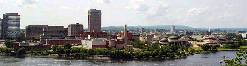
The Hull bank
Back to the Ottawa River, for this post.
Standing outside the Musée des Civilisations in Hull, you're awarded the best view of Parliament Hill in the National Capital Region. From the Hill itself, the view is also good, but marred to some extent in its glamour by the toilet paper factory straight ahead of you.
Some say that the skyscrapers, government offices rising from the Place du Portage, do not enrich the view either; that's a matter of taste. The plumes of steam on winter days are a dramatic enhancement. In the nineteenth century the steam and the mills were on the Ontario side.
Next to the paper products factory is an interesting memorial to the original industry that gave this part of Canada its prosperity, the lumber trade. On this spot once stood a matchstick factory belonging to E.B. Eddy, and the still-standing stone tower was part of it. The next thing downstream to be noticed on the Hull bank is the distinctive architecture of the museum, and in the distance, the Gatineau Hills.
Standing outside the Musée des Civilisations in Hull, you're awarded the best view of Parliament Hill in the National Capital Region. From the Hill itself, the view is also good, but marred to some extent in its glamour by the toilet paper factory straight ahead of you.
 |
| Wikipedia photo, taken in summer time |
Next to the paper products factory is an interesting memorial to the original industry that gave this part of Canada its prosperity, the lumber trade. On this spot once stood a matchstick factory belonging to E.B. Eddy, and the still-standing stone tower was part of it. The next thing downstream to be noticed on the Hull bank is the distinctive architecture of the museum, and in the distance, the Gatineau Hills.
 |
| The Hull bank from Nepean Point, this photo more typical of the current season |
Tuesday, February 22, 2011
The third river
I began this blog assuming that I'd only want to write about the Rideau River, near our house, but that didn't last long; I then chose to add some description of the Ottawa River too. Now I'm going to compromise my intentions further by adding the mention of the third river of interest to me and other Ottawa citizens, the Gatineau, which flows into the Ottawa opposite Rockcliffe Park (affording one of the best views in town) at Pointe Gatineau, under the Lady Aberdeen Bridge. For comparison, the Gatineau is 386 km, the Ottawa River 1271 km, the Rideau River 146 km in length. Impressive rivers, all three.
Yesterday four of us drove up the Gatineau valley to Wakefield, a favourite destination, lunching at Chamberlin's Lookout (above the General Store) which boasts a panoramic view of the Gatineau River and the village. I always get a sense of well-being when I'm there, looking at this view.

Yesterday four of us drove up the Gatineau valley to Wakefield, a favourite destination, lunching at Chamberlin's Lookout (above the General Store) which boasts a panoramic view of the Gatineau River and the village. I always get a sense of well-being when I'm there, looking at this view.

Sunday, February 20, 2011
Illusion
Glancing briefly up or down the Rideau at present, especially at night, you'd think there were patches of clear water. However, it's an illusion; that is not water but a sheen of black ice reflecting any light there might be. The sun melted some snow off the surface of the river on Friday, when we had a suddenly warm day, the temperature rising to 11ºC, but everything that was damp out of doors has frozen solid again now. The footpaths are treacherous. Winter is not over yet.
Saturday, February 19, 2011
Cutting the keys
 |
| Photo from the Ottawa Citizen |
In other words, the ice breaking, or flood control operations have begun on the Rideau River in Ottawa. It takes five men to manipulate the heavy circular saw with another standing by to supervise. Each year, the work begins under the Sussex Drive bridge, just above the Rideau Falls, with the cutting of these slits in the ice, and then follows the blasting (due to start a week today). Here's another detail I hadn't known until I read about it just now:
An ice control boom is installed in the late fall at Strathcona Rapids to slow the surface flow to promote an ice cover and limit the volume of frazil ice (slush), anchor ice and 'hanging dams' in the river. The ice control boom increases the efficiency of ice breaking and clearing operations in February and March.The Strathcona Rapids are a couple of kilometres upstream from our part of the river, by Strathcona Park.
Thursday, February 17, 2011
View from a highrise
Here are two views from a balcony on the 17th floor of 400 Stewart Street, where I was this morning, looking up and down the Rideau. This building, named Rio Vista, has 24 floors in total. It's listed on Ottawa's Skyscraper Page.
(This island, by the way, has a history; in the nineteenth century, the Cummings family ran a general store on this site, but only trees stand there now.)
 |
| Cummings Bridge over the Rideau, showing Cummings Island and Montreal Road |
 |
| The Rideau River, looking upstream (south) from an apartment in Rio Vista |
Tuesday, February 15, 2011
Condos with a view
Martin Elder, an enthusiastic real estate agent in Ottawa, posts this status report on his "wall":
Richmond road in Westboro is busy with the sounds of BIG costruction. Condos and more condos. What a great life!and gets this comment from one of his Facebook friends:
The main reason I don't like condos, is that they generally obscure the skyline, and replace older homes or businesses that had character and charm.Martin replies:
You're right. It's unfortunate that so many condos are built along the river front where they block the view for long time residence. But think of the condo people who have magnificient views of the river. There is no win here—it's where people want to live and there is a growing trend of people who choose to walk to the village and live a denser community life. Each condo represents a social group by and large. Fascinating to witness.As a footnote to this, I heard an interesting comment at the public meeting I attended last month (about the proposed new condominium on Bruyère Street). It's been proven in demographics research that people owning properties at ground level are more likely to get involved in community affairs than the occupants of high rise buildings.
Monday, February 14, 2011
Goodwill
While being driven across St. Patrick Bridge yesterday I caught a glimpse of a giant word stamped out in footprints in the snow, spanning the river:
P E A C E
All washed out today, I expect; it's raining now, but the thought was there.
Sunday, February 13, 2011
In Strathcona Park
 |
| Cummings Bridge from Strathcona Park |
The park has a riverside path from which there's a good view of Cummings Bridge connecting Sandy Hill to Vanier across the River Rideau. In summer there are outdoor plays in the park: Theatre Under The Stars. Only the squirrels playing in winter, though. We saw a whole family of them leaping around in the tree tops.
 |
| Strathcona's Folly with Range Road behind it |
Strathcona's Folly is intended to encourage us to consider the cycle of life. It is constructed using real pieces of local architectural history like adult sized toy building blocks. There are pieces of …a convent on Sussex Drive, stone faces from a branch of the Bank of Montreal, balustrades from the Château Laurier Hotel, bits of the Royal Canadian Mint, the Capitol Theatre, the Windsor Duvernay Hotel, the Parliament Buildings, bronze rosettes from the Daly Building, and even one of the old swing seats from the park.
Friday, February 11, 2011
Anticipation
 |
| Ice clearing operations about to start from Maple Island |
The first trucks arrived yesterday and parked on Maple Island from which they can drive onto the river. Snow has been swept away in a strategic line right down the centre of the river revealing its solid surface. This is where they will start cutting into the ice. Towards the end of the month, the dynamiting will follow and then the amphibious ice-breaker. (More about this later.)
Thursday, February 10, 2011
On River Road
Finding ourselves in Manotick today—a friend drove me there on a whim—we had lunch at the Black Dog on the High Street, spent a while admiring the premises of the Mill Street Florist, and returned home along River Road which eventually runs into Riverside Drive. Within the city proper, River Road reappears, calling itself River Road North as it follows the east bank through Overbrook and Vanier, with attractive houses and parks all the way along.
The small town of Manotick, a reporting point for air traffic on the VFR approach to Ottawa International Airport, is built on and around an island in the River Rideau. In fact, Manotick's name is an Ojibwe word meaning "island in the river" and the first nineteenth century settlement there was based on the island around a mill that's still occasionally operational, Watson's Mill. We passed the mill today, driving onto the island across the bridge that offers a view of the tumbling weir beside it.
On one side of the river runs Rideau Valley Drive and, on the other side, River Road, both routes allowing for a pleasant ride to and from the city. Near Manotick there's a row of "monster houses" (as people call them) along River Road, American style riverside properties for the very rich! As you drive north you approach the city of Ottawa through the residential suburbs of Riverside South and the romantically named Heart's Desire (near the Jock River where it flows into the Rideau). I know an old lady who has just moved out of her house on the banks of the Jock into a retirement home and must miss her view of the water terribly at the moment. We had another elderly, widowed lady in the car with us who lives on the 17th floor of an appartment block overlooking the Rideau within the city, and she said she wouldn't have stayed in the city if she hadn't had the consolation of that view. My river, she called it, as we came to the end of our drive—"We have followed my river all the way down."
Wednesday, February 9, 2011
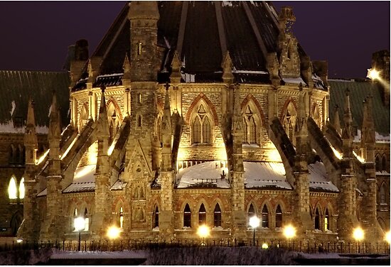
In the shadow of Parliament Hill

In this photo, taken from Major's Hill Park, the Parliament library, Ottawa's most beautiful building (which has recently been renovated) casts its distinctive shadow over the river, and in the background, on the next headland, stands the Supreme Court of Canada.
Tuesday, February 8, 2011
Birds of passage
| (photo from the Ottawa Citizen) |
Migratory birds follow rivers on their journeys, and the ones I'm looking forward to seeing (and hearing overhead) are the geese. Their honking, in another few weeks' time, really will announce the return of milder weather to our part of the world.
As I write this, the recorded temperature at Ottawa airport is -15º ("feels like -26º" in the wind) which must be why I needed to put my hood up when I went out of doors.
Monday, February 7, 2011
Making the most of the ice

Here are a few of the temporary fishing huts on the Ottawa River, viewed from a couple of thousand feet. In the bottom right hand corner (click on the picture to enlarge it) you can see that the fisherman has made a row of eight holes with his auger. This particular cluster of huts on the south side of the river was a small one, but along other stretches, such as the north side, east of Gatineau, as shown in my second picture, the layout is so well organised you could call it a town, with visitors (either on snowmobiles or in vehicles on wheels) zipping along the ice streets. Some huts have little ice rinks in their front "yards."


It isn't only the fishermen who clear away the snow to make skating rinks on the river; shore-dwellers do this too. Here's a home-made rink just off shore by Old Highway 17, probably shared by the nearby homeowners who meet on the river for a game of hockey.
Meanwhile, in the city, sculptors have been playing with ice in a more professional way, etching stylized fish, for example, onto carved blocks, for Winterlude's "Crystal Garden."

Sunday, February 6, 2011
Flying from Rockcliffe to Lachute and back
 |
| A "Cherokee" based at Rockcliffe Airport, flying south of the Ottawa River |
A scenic ride from Rockcliffe to Lachute and back via Hawkesbury, such as the one several of us undertook today, follows the same route as the river:
 |
| The museum at Rockcliffe airport, from the north |
 |
| Flying towards sunnier weather, between Ottawa and Hawkesbury |
 |
| The road bridge at Hawkesbury |
 |
| New bridge (on autoroute 50, not yet completed) across the rapids of the Rivière Rouge, near Hawkesbury |
 |
| Not far from Rockcliffe on the return flight: passing the Cumberland ferry |
Saturday, February 5, 2011
Fireworks from the bridge
 |
| Carol's photo, from the park last night |
Even from inside our house, apparently, the explosions sounded loud.
| Reuters picture of Winterlude fireworks |
Well worth the chilly outing, a beautiful show. I was talking to a Japanese lady yesterday who lives downtown on the 23rd floor of an apartment block. She told me that she would be watching, for sure.
The operations base is outside the Museum of Civilisation on the north bank of the Ottawa River. For comparison's sake, click here for a recording of last year's similar display.
Friday, February 4, 2011
Beside the Ottawa again
 Our snowshoeing group returned to the south bank of the Ottawa this morning, walking down the hill to the trail from Rothwell Heights. When we came to the "water's edge," so to speak, Anne-Ute (from Germany) said, incredulously, "Is that the river?" Having been assured by me that it was, she took this picture of me at the boat launch ramp, with the Quebec bank in the distance.
Further along the trail was an attractive line of sumac bushes, their black branches and dark red drupes silhouetted against the whiteness of the river and the greyness of the sky. Staghorn sumacs such as these are a traditionally very useful plant.

Wednesday, February 2, 2011
New bridge across the Rideau?
It seems there are plans to erect a bridge for the use of cyclists and pedestrians across the Rideau River just south of Strathcona Park from the Overbrook / Vanier district to Sandy Hills. Apparently there used to be a rickety wooden bridge that served the same purpose, crossing the river from the Rideau Tennis Club at Donald Street, across the shallow water there.
If the project goes ahead it would facilitate a pleasant evening bike ride for us, up one bank of the river and down the other, although it is already possible to do that by crossing slightly further upstream on the existing footbridge just beyond Highway 417 (from Lees Avenue to Hurdman Park).
For a list of all the bridges in Ottawa, click here.
Tuesday, February 1, 2011
Winter sun going down
On a summer evening, if you're looking down the final stretch of the Rideau River before it pours over the Rideau Falls into the Ottawa, the sun goes down behind the Gatineau Hills at Camp Fortune, and the coloured sunset is reflected in the water between the Minto Bridges and the falls.
However, if you're on the New Edinburgh bank of the river in winter, the sun sets in a more southwesterly part of the sky, silhouetting the towers on Parliament Hill, and doesn't reflect in the river because there isn't any water visible, but it does light up the surface of the snow.
 On our way back from a longish walk around Rockcliffe Park this afternoon the pathway beside the river at the St. Patrick Bridge looked irresistible, side-lit by low sunbeams through the evergreens, so instead of heading down the road, we came home the longer way round. I couldn't capture its appeal on my camera which had run out of power, too cold for the batteries to last, so had to take this picture using my cellphone.
We're unlikely to see the sun again tomorrow because a "major winter storm" is forecast, due to last all day.
Subscribe to:
Posts (Atom)